The Allegheny Trail (ALT) is a 300ish mile N/S (or S/N depending at which end you start) trail that traverses WV, mainly through its eastern highlands, from the Mason-Dixon line on the WV/PA border about 6 miles north of Bruceton Mills, WV and a tad to the West. The trail ends in Monroe County, West Virginia, the southern-most county, approximately 300 miles later.
The West Virginia Scenic Trails Association is a trail advocacy group and the primary caretaker of the Allegheny Trail. Visit their website, donate, volunteer, get outside.
When I was a kid, about 30 years ago, my dad was very active with the West Virginia Scenic Trails Association and was always dragging me along on trail building/maintenance weekends. This directly influenced my affinity for the outdoors, hiking and backpacking. As a grown-ass woman, I am retracing many of my steps and section-hiking the entire route from North to South with my friend Naomi (a 68 year old rabble rouser) and any other sucker who says yes to an invite to join us some weekend.
Naomi and I conquered the first 32 miles the weekend of June 16-18, 2012. We hiked from the northern terminus at the mason-dixon line to Rt. 7 near Terra Alta.
 |
| this is an overview map of the first 32 miles of the Allegheny Trail heading north to south. |
I took a bunch of pictures of our first leg, which was really a slow-paced tour through rural West Virginia. We hiked through beautiful farmland and some wooded areas of Preston County from Bruceton Mills to Terra Alta.
 |
| Naomi at the Mason-Dixon Trailhead at the northern terminus. |
 |
| beautiful preston county farmland just south of the mason-dixon trailhead |
 |
| Mt. Grove Church. |
 |
| Naomi waiting for me to put my damn camera up. |
 |
| impoundments along the trail. |
 |
| this is an old rundown one room school house. the house is dilapidated but someone mows the yard. interesting. |
 |
| allegheny trail yellow blaze on I68 pier over the road to Pisgah off of Rt. 73 |
 |
| we camped the first night along big sandy. if you went to wvu and drank beer, it's very likely you came out here to party. |
 |
| heading out morning of day 2 of the first 32 miles. day 1 we accomplished 11.6 miles with heavy packs and still felt pretty good the morning of day 2. |
 |
| the bridge crossing at big sandy. notice the allegheny trail blaze. |
 |
| big sandy morning. |
 |
| big farm on mountain above big sandy just before mt. nebo. think the dog is in charge? |
 |
| guess again |
 |
| mt. nebo baptist church. the church sign was full of bird shot. |
 |
| hickory grove road. |
 |
| this barn belonged to a very nice family on hickory grove road who let us fill up with their chlorinated water. the water was otherwise untreatable acid mine drainage. |
 |
| acid mine drainage along hickory grove road above cheat canyon and the town of albright. |
 |
| small church on beech run road just before descending into albright along the mighty cheat river |
 |
| we spent night 2 at cheat canyon campground just outside of albright. the little exxon in town had one decent selection of beer. thankfully. the night was dark and full of terrors in the form of several passing thunderstorms. by morning, the rain had stopped and it was nice and cool. |
 |
| beautiful cheat river on the morning of day 3 |
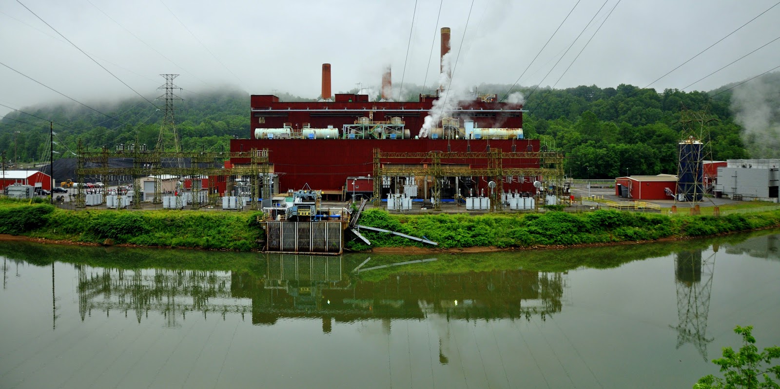
 |
| albright powerplant. |
 |
| top of daugherty run. this area is very close to the reclaimed roaring creek strip mine. it's very beautiful farmland. on a clear day, you can see kingwood from this perch. |
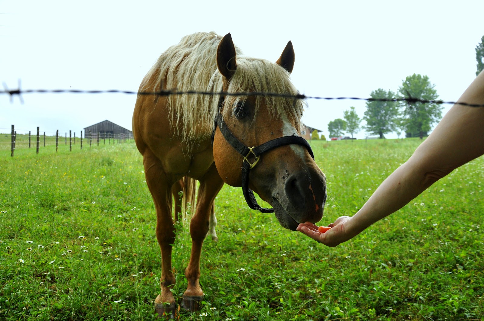
 |
| naomi fed this very friendly horse some of our carrots. |
 |
| these cute little buggers were out by the dozens in the damp and steamy morning. |
 |
| this looks out over a very impressive and long hollow we just hiked up. about half a dozen streams drained into this hollow. much of the trail on the way up was literally through the creek bed of the main creek. treacherous to say the least, but fun nevertheless. |
 |
| beautiful preston county farmland ridge. just over this ridge is our car at the take out spot. 32 miles down, 268 to go. stay tuned. |


Love This!!! Great and inspiring photos. Can't wait to see the next leg of the journey.
ReplyDeleteThis is why I love the East coast. Beautiful mixture of the ancient and the new, of natural and manmade. The Alleghenies are beautifully close around you, intimate and physically accessible. I'll have to add this to my retirement dream list.
ReplyDeleteThis is great! Glad to hear people are thru-hiking the ALT. When you get south of Glady...The ALT on Shavers Mtn south of the junction to High Falls of the Cheat and north of Gaudineer Knob was faint in spots with numerous blowdowns in May 2011. The WVSTA maintainer said they'd try to hit it summer 2011. It was passable but had to stop and look for the trail in spots and climb around and over blowdowns. Hope you 2 make it the whole way. Looking forward to reading future blog entries.
ReplyDeleteHey, Sweat Hog, Thanks for the update on trail conditions. Might be lots more blowdowns after the big "derecho" storm week before last.
DeleteNaomi
So, when's the next section going to be hiked? Look forward to following your adventure on the Web, and maybe following your footsteps some day.
ReplyDeleteCross Lanes Curmudgeon
I'm hoping we get a chance to get out in September some time. We're trying to avoid the hottest days of the summer. Rest assured there will be a run on treks this fall. At the very least, we will get two more legs in before winter and maybe do a cabin to cabin snowshoe in the winter when we get to the Blackwater/Canaan Valley portion of the trail. I'll post pre-trek, when we get the next legs scheduled, to keep ya'll updated.
ReplyDeleteI'm a longtime friend of Naomi's. It sounds like the two of you do well together. I'm impressed with you guys and looking forward to future posts.
ReplyDeleteSection one is now newly blazed and easy to follow. Section two is newly blazed from BWF State Park to Wildell Shelter on Shavers Mountain but be aware that there are many blow downs from the storms in late 2012 causing some scrambling but can be easily followed. From Wildell to Cass is planned to get blazed summer 2013 and as of this post some parts are difficult to follow. Will post as progress is made to Cass. Enjoy the trail!
ReplyDelete